About Us
Key Personnel
Rachel H. Mohler, President and Owner
Rachel H Mohler became President of MAPS in October 2006. At MAPS, Rachel is in charge of all contracting, billing & receivables and day to day operations.
Prior to starting the company in 2006 her broad experience has included working in Quality Control, Office Management and Department Head for various companies. Rachel's experience does not stop on the office side of the business as she also has experience out in the field working with survey crews. She's as comfortable running the Sokkia SRX Robot as she is working with Quickbooks.
Rachel's educational background includes attending Kent State University, Ohio 1995-1999 BFA Program. Rachel has also sought out continuing educational workshops at the Woman's Business Center of Northern Virginia to help her business' continual growth.
Thomas Gregory (GREG) Pendleton, LS, RLS
Greg is a licensed surveyor in the District of Columbia, Maryland and Virginia and is a Registered Land Surveyor with the District of Columbia Office of the Surveyor. Greg has over 30 years of experience in land surveying including boundary, ALTA, right-of-way and design and layout. Greg's education experience includes majoring in mathematics at Christopher Newport University and coursework in Land Surveying at Old Dominion University.
Brian T. Mohler, PROF. LS
Brian has over 15 years of combined education and experience in land surveying, including storm water management and boundary law. Brian is a licensed surveyor in the District of Columbia, Maryland, Pennsylvania, and West Virginia. Brian received his Bachelor degree in Surveying and Mapping from the University of Akron, and holds an Engineering certificate in Storm Drainage Design from CC Baltimore County.
Both Greg and Brian work equally well in project management and field and office technical procedures, and both are involved with all aspects of land surveying at MAPS, from project inception to final deliverables.
Insurance
MAPS carries General Liability, Errors and Omissions, Worker's Compensation and Professional Automotive Insurance and has been claim free since our incorporation in 2006.
Certifications
- Metropolitan Washington Airport Authority
LDBE Certification no. LD2007-0100-2100 for NAICS 541370 Surveying and Mapping (except Geo-physical) Services - Maryland Certified Small Business
SB10-2086 - Federal Woman-Owned Small Emerging Business
ORCA and CCR Registered DUNS 78-938-3788 - HAZWOPPER 40 Hour and Supervisory Certification Principals
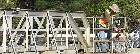
Equipment
- Leica Dual Frequency Static and RTK GNSS/GPS
- Leica Robotic / Reflectorless Total Stations
- Digital Levels (Leica DNA 10)
- DJI Phantom UAS
- Leica Laser Scanning
Utility Designation
- Radio detection CAT3 Passive Radio Induction
- MetroTech 810 Active Radio Induction
- Vivax MetroTech Vloc-9800 Passive and Active Radio Induction
Software Platforms
CAD and Site Civil
- All CAD files are prepared according to the National CAD Standards unless otherwise requested. (MAPS) supports all local standards including VDOT, DCDOT, SHA, EFLHD, NPS and the AOC and can provide deliverables per client standards upon request.
- AutoDesk Civil 3D 2021
- Carlson Survey, GIS and Point Cloud
- Microstation 8i with InRoads PowerSurvey
Least Square Adjustment
- MicroSurvey StarNet Version 7 Professional
GIS
- AutoCAD MAP 2021
- ESRI ArcGIS
- Quantum Open Source GIS